Aerial Roof Measurements: A Roofing Contractor’s Competitive Advantage
New techniques and technology can now extract precise property data from high-resolution aerial imagery specifically designed to provide estimators with unprecedented insight on the roof projects they are bidding

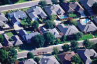
A high-resolution top-down view of a U.S. suburban area.

A close top-down view.


In recent years, roof measurements based on aerial imagery have revolutionized the way many restoration contractors work by eliminating some of the pains involved with measuring and estimating roof repairs. It’s also given early adopters an edge over competitors when bidding roof projects. Recent advancements in aerial data collection present another opportunity for restoration professionals to evolve and incorporate new ways to be more efficient and competitive.
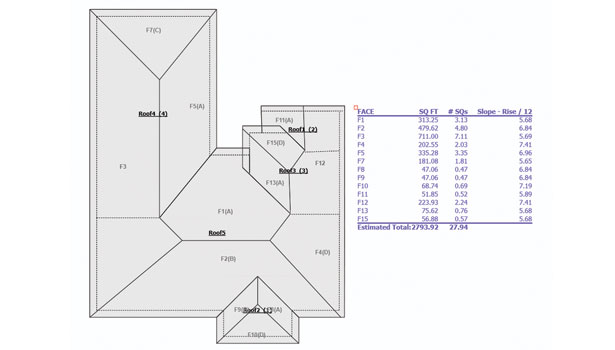
New techniques and technology can now extract precise property data from high-resolution aerial imagery specifically designed to provide estimators with unprecedented insight on the roof projects they are bidding. This data can include a fully functional digital roof plan, information on all roof dimensions and slopes and a set of high-resolution aerial images - essentially everything an estimator needs to start estimating roof repair costs. The way contractors apply the data is what sets them apart from their competitors. Here are a few ways to maximize productivity and efficiency when incorporating aerial data into the estimating workflow:
First, get aerial data at the onset of a project. Even simple roof layouts can take up to an hour to dimension by hand when time is factored in for setting up the ladder, climbing all over the structure, recording measurements and drawing the diagram. Having the data in hand from the beginning allows estimators to simply verify a few key measurements to ensure the accuracy of the roof diagram before they bid the project and discuss the scope of work with the homeowner or insurance carrier.
Arriving on site with an in-depth knowledge of the structure not only makes estimating much faster, it leaves a positive impression with the homeowner and sets the contractor apart from others who needed to take time to measure the roof, which in some cases can cause delays and slow claims settlement. Leveraging aerial data from the onset of a project can also do much to reduce the risk inherent with dimensioning steep, complex roofs.
The Bureau of Labor Statistics reports that falls to lower levels accounted for 544 fatalities in 2012. Contractors are keenly aware of the dangers and take many precautions to avoid mishaps. When the slope is deemed too steep, some will measure the edge from the ground or from a ladder rather than risk scaling the roof. But this process can be time-consuming and reduce accuracy. Aerial data can help contractors minimize risk and liability by obtaining all necessary dimensions, slopes and insight without having to set foot on the roof.
Another key to increasing productivity is making sure aerial data integrates seamlessly with the estimating system the contractor uses. No matter how precise the data, it will do little good if contractors don’t have an easy way to get it and put it to use. With the right estimating system, contractors can request aerial data from desktop, laptop, online and mobile platforms and have it delivered right into their estimating system. This means as soon as they receive the data, they can estimate costs for shingles, underlayment, drip edge, sheathing, soffit and fascia, rain gutters and anything else they need to restore the structure. In addition to streamlining estimation, this approach gives contractors leeway to easily adjust their bids if the scope of the project changes.
Ensuring aerial data can be modified as needed is key to optimizing productivity and efficiency. Suppose a homeowner changes his or her mind about the scope of a project. If a contractor is using static measurements and reports, it can take hours to revise the project so it fits the homeowner’s new parameters. But if the contractor is using aerial data that is integrated into the organization’s estimating and reporting solutions, changes can be made quickly and the reports will update immediately. Giving crews the ability to modify reports on the fly will help alleviate some stress by eliminating the need to start from square one whenever the customer requests a few “minor” tweaks. These are just a few ways contractors can utilize aerial data to be more competitive.
With training and the right tools, contractors can use aerial data to increase productivity and make a strong case for why insurance carriers and homeowners should rely on them to accurately estimate damages and quickly get the property restored to its pre-loss condition.
Looking for a reprint of this article?
From high-res PDFs to custom plaques, order your copy today!


